Accessing Vexcel Imagery in ArcGIS Pro
Creating an XYZ Imagery Layer:
1. Generate an Authentication Token:
Each user who will access Vexcel Imagery Services will need to generate a unique authentication token. Once you have been provided Vexcel Platform credentials, you can generate a token by logging in to the Vexcel API found at https://api.vexcelgroup.com/. Refer to the Vexcel API Documentation: Authentication Token Services for more information.
2. Create your XYZ Layer with Token
After generating your authentication token, you can use the following base URL, entering the Elements Roadway dataset (layer, AOI and childAOI) values and your unique token value. https://api.vexcelgroup.com/images/GetOrthoImageTile/{layer}/{z}/{x}/{y}?aoi={aoi}&childAOI={childAOI}&token={token}
URL Example:
Unique URL parameter values required for each user and Roadway Elements dataset are highlighted in blue below:
https://api.vexcelgroup.com/images/GetOrthoImageTile/bluesky-ultra/{z}/{x}/{y}?aoi=us-or-medford-2023&childAOI=us-or-medford-2023&token=[your_token_here]
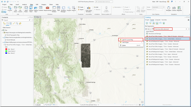
To access Vexcel Imagery in ArcGIS Pro [Vexcel Image Services for ArcGIS]:
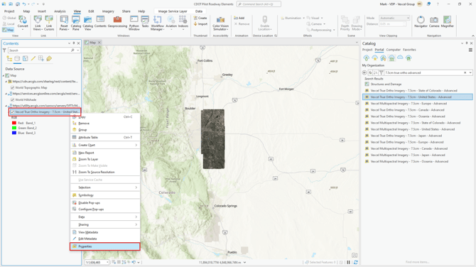
- Using Catalog, navigate to your Portal and search for Vexcel Imagery. Select the image layer needed, right click and select Add to Current Map.
2. In the Data Source Manager | XYZ dialog box, enter the OrthoImageTile service URL and values specific to the elements roadway data (layer , AOI and childAOI) found in the elements.csv file and your unique token value.
3. Set the Max Zoom Level to 21 and click OK.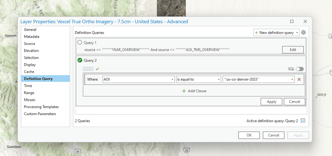
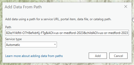
Accessing Vexcel Imagery in ArcGIS Pro [Data From Path]
To access Vexcel Imagery:
-
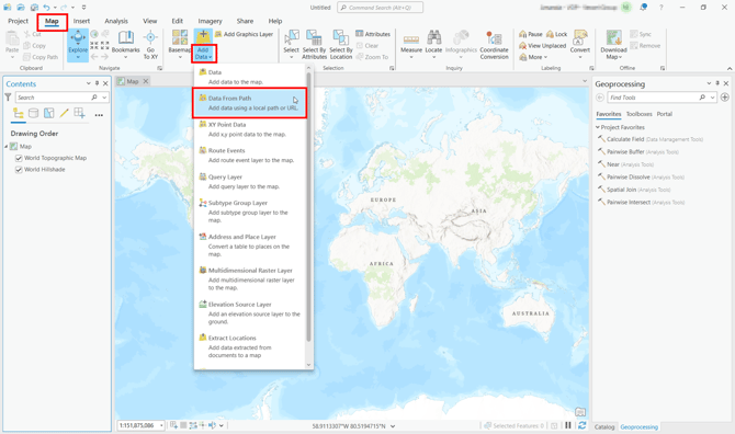
Select the Map tab at the top. In the Layer section, click on the Add Data dropdown and select Add Data > Data From Path.
-
In the Add Data From Path dialog box, enter the OrthoImageTile service URL and values specific to the elements roadway data (
layer,AOIandchildAOI) found in the elements-roadway.csv file and your unique token value.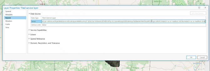
-
Set service type to Automatic and click Add.
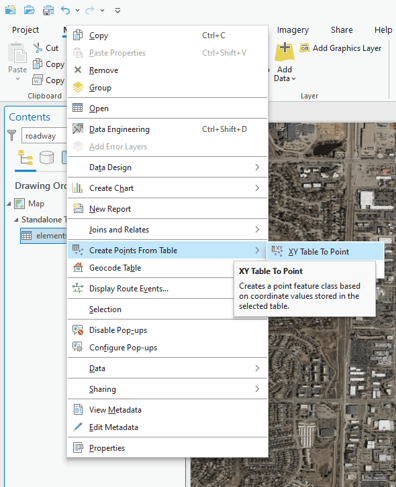
Displaying Elements Roadway Data in ArcGIS Pro
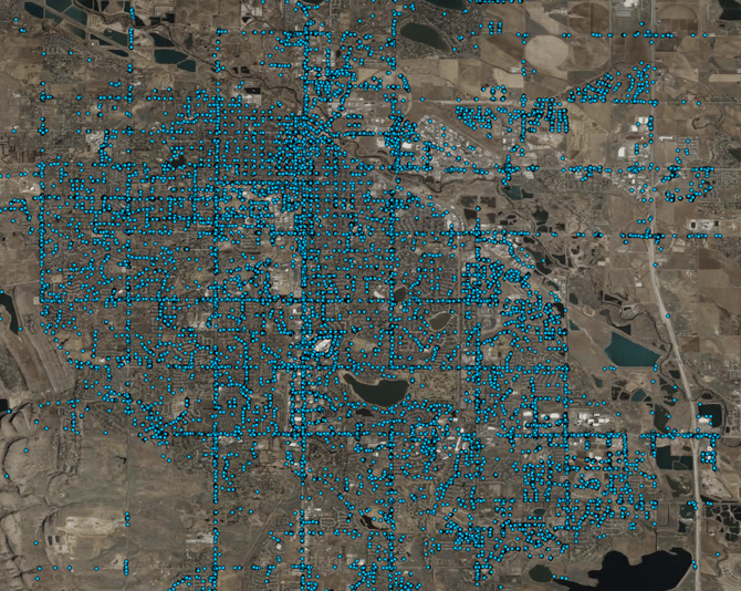
You can display the detected roadway elements as points using the long and lat fields, as polygons using the bbox_wkt field, and lines using the crossing_wkt field (crosswalks only).
Display as Points
The centroids of the AI Bounding Boxes can be used to display the detected roadway features as points.
-
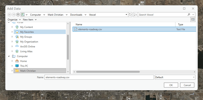
Select the Map tab at the top. In the Layer section, click on the Add Data dropdown and select Add Data.
-
Browse to the folder location of the elements-roadway.csv file and click OK.
-
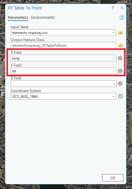
In the Contents panel, select the elements-roadway.csv file, right-click, and select Create Points From Table > XY Table To Point. Set the X field to
longand the Y Field tolat. Click OK.